Guidebook: Stedman's "Kilimanjaro: A trekking guide to Africa's Highest Mountain"
After returning to my blog after a several year hiatus, I was pleasantly surprised to note that I was getting a bit of traffic from the website: http://www.climbmountkilimanjaro.com/ , which had links to a number of blogs including this one. What was even more flattering was finding out that this website was maintained by none other than Henry Stedman, who is the author of what is in my opinion, the definitive guide to trekking on Kilimanjaro. Go to amazon.com and search kilimanjaro... as of 2012, there is not another guidebook that has a higher rating (5 stars) or number of reviewers than Stedman's "Kilimanjaro: A trekking guide to Africa's highest mountain."
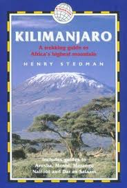
Looking back at my posts for the first time in what seems ages, I was a bit horrified to note that not one made mention to Stedman's guidebook, which was the bible that helped prepare me prior to the trip, as well as serve as my reference on the mountain itself. In addition to having sections on each of the major routes, it also provided a good amount of background information on the mountain and region, to help put in context what I was experiencing on the hike itself. Internet access was not available on Kili when I made my trek in 2006, as as far as I'm aware its not available in 2012! So for information geeks such as myself, this guidebook was worth the effort to carry. Its actually very compact (5 X 7 inches, ~ 0.5 lbs/ 250g). I used the 2nd edition (blue cover below); but there is a new updated version that I have not seen.
Stedman's guide along with a map are what I carried on the mountain itself (International Travel Maps: Kilimanjaro; you can google this. It is a very good scaled topo map) .
I've also since taken a look at Stedman's website. Although I haven't yet had the chance to read everything in detail, I will say that this appears to be one of the most comprehensive and well organized websites on Kilimanjaro trekking. Once again, the information geek in me appreciates the amount of useful background detail on the mountain, along with the practical/essential tips. This website might have existed at the time I did my trip in 2006, but it certainly wasn't in the format that is today. I undoubtably would have used this as my reference point if I was planning my trip in 2012.
This post may be a belated way of returning the favor to a website/author (THE definitive Kili expert?) who graciously made mention of my blog. However, while for me Kilimanjaro was a singular event that impacted my life, for Henry Stedman, Kilimanjaro is an ongoing passion, and he continues to accumulate further experience and knowledge that is shared in his book/website. I would be making the same recommendation regardless of whether or not Stedman had ever laid eyes on Kilimanjarotomorrow.
Looking back at my posts for the first time in what seems ages, I was a bit horrified to note that not one made mention to Stedman's guidebook, which was the bible that helped prepare me prior to the trip, as well as serve as my reference on the mountain itself. In addition to having sections on each of the major routes, it also provided a good amount of background information on the mountain and region, to help put in context what I was experiencing on the hike itself. Internet access was not available on Kili when I made my trek in 2006, as as far as I'm aware its not available in 2012! So for information geeks such as myself, this guidebook was worth the effort to carry. Its actually very compact (5 X 7 inches, ~ 0.5 lbs/ 250g). I used the 2nd edition (blue cover below); but there is a new updated version that I have not seen.
Stedman's guide along with a map are what I carried on the mountain itself (International Travel Maps: Kilimanjaro; you can google this. It is a very good scaled topo map) .
I've also since taken a look at Stedman's website. Although I haven't yet had the chance to read everything in detail, I will say that this appears to be one of the most comprehensive and well organized websites on Kilimanjaro trekking. Once again, the information geek in me appreciates the amount of useful background detail on the mountain, along with the practical/essential tips. This website might have existed at the time I did my trip in 2006, but it certainly wasn't in the format that is today. I undoubtably would have used this as my reference point if I was planning my trip in 2012.
This post may be a belated way of returning the favor to a website/author (THE definitive Kili expert?) who graciously made mention of my blog. However, while for me Kilimanjaro was a singular event that impacted my life, for Henry Stedman, Kilimanjaro is an ongoing passion, and he continues to accumulate further experience and knowledge that is shared in his book/website. I would be making the same recommendation regardless of whether or not Stedman had ever laid eyes on Kilimanjarotomorrow.
posted by Phil at 5:21 PM
10 comments


